



The Catalan Atlas .. How Did Europe Depict the East 650 Years Ago?
A Reading of an Article by Dr. Susan Abed
Overview
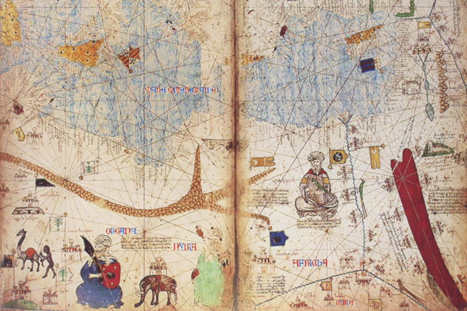
In a rich and insightful study, Dr. Susan Abed examines the Catalan Atlas, one of the most renowned European maps of the fourteenth century. Completed around 1375, it is regarded as one of the most significant cartographic achievements of the Middle Ages.
The study explains that the atlas was far more than a geographical map. It was a visual narrative that combined accurate maritime knowledge, travelers' accounts, legends, and European perceptions of the world—particularly of Africa and Asia.
Dr. Abed notes that the atlas presented a more realistic depiction of North Africa than many contemporary European maps. It also portrayed historical figures such as Mansa Musa, documented trade routes, seas, and ports, while large parts of Asia continued to be represented through a blend of reality and legend.
BETH Analysis
The importance of the Catalan Atlas lies in the fact that it does not simply show us the world as it was...
It shows us how Europe imagined it.
Maps are not merely tools for measuring geography.
They are also historical documents that reveal how civilizations think, what they know, what they do not know, and how they imagine others.
Reading the Catalan Atlas today is therefore not simply a study of historical cartography.
It is a study of the history of knowledge and of how collective perceptions are formed.
Yet this European narrative was not the only one.
At a time when much of Europe's understanding of the East was shaped by travelers' accounts and legends, Arab and Muslim scholars had already established a more systematic scientific tradition of cartography.
In the twelfth century, Al-Idrisi produced his celebrated world map, drawing on direct observation and the accounts of merchants and travelers, creating one of the most accurate representations of the known world for its time. He was preceded and accompanied by leading Muslim geographers such as Al-Khwarizmi, Ibn Hawqal, Al-Muqaddasi, and Al-Istakhri, who viewed maps not merely as representations of distance, but as instruments for understanding human settlements, economic activity, trade networks, and cultures.
This is where the comparison becomes particularly meaningful.
The Catalan Atlas represents an important milestone in the development of European geographical knowledge. However, it emerged centuries after the flourishing of Arab and Islamic scholarship in geography and cartography. Research indicates that some of these earlier contributions enriched the geographical knowledge later available to the makers of the atlas, alongside European sources and travelers' accounts.
The true value of the Catalan Atlas, therefore, does not lie in being the first European attempt to depict the world.
Rather, it reflects how Europe gradually began constructing its own vision of the world, drawing upon an accumulated body of knowledge to which Islamic civilization had made a substantial contribution.
Another Perspective
A map is more than a drawing of the Earth.
It is a portrait of the mind that created it.
Every map tells us something about the world.
But it tells us even more about the people who drew it.
Studying historical maps is therefore not merely a journey through geography.
It is a journey through the history of ideas, revealing how civilizations understood themselves—and how they perceived others.
Prepared & Analyzed by | Strategic Media Department – BETH Agency | B
Based on an article by Dr. Susan Abed (Arab Thought Foundation), with additional analysis and commentary by BETH Agency.